This time, we will tour the area of the Beit Meir moshav, to become familiar with a main angle of the War of Independence – The campaign for the road to Jerusalem.
Nature of the Tour: On foot
Length of the Tour: 2-3 hours
Degree of Difficulty: Easy
Starting Pointing: Put “Post 16 Site in Ha-Masrek Reserve in Waze
Background: David Ben-Gurion and the Campaign for Jerusalem
“Almost from the very first moment, Jerusalem stood at the center of the campaign for Israel’s revival and was the focal point of the War of Independence” (David Ben-Gurion)
The War of Independence, which lasted over a year and a half, is divided into two central parts. The first part began immediately after the UN resolution on the partition plan on November 29, 1947, and was characterized by a civil war between the Jews and Arabs within Israel. The second part began after the Declaration of Independence on May 14, 1948 and was characterized by the invasion of the Arab armies into Israel.
In the first phase of the war, Arab Israelis focused most of their efforts in blocking roads to isolated towns. The Arab operations focused upon the road to Jerusalem. The reason: the Arab military leadership understood what David Ben-Gurion understood: Jerusalem is the beating heart of the Jewish people. Without Jerusalem, the idea of a Jewish state would sustain a critical, perhaps even deadly, blow.
The central goal of blocking the road to Jerusalem was to prevent the arrival of food supplies to the city, thus starving it into surrendering. Central focus of the struggle was on the road that passed through Sha’ar HaGai (“Bab al-Wad” in Arabic) and the attempts by the Hebrew Yishuv to get supply convoys through it to Jerusalem.
During our tour today, we will focus upon the area of Sha’ar HaGai and particularly its strategic weak points, which are revealed when visiting the ridges that were controlled by the Arabs, who blocked the road to Jerusalem.
Ducks in a Shooting Gallery: what did it mean to be a driver in a convoy to Jerusalem?
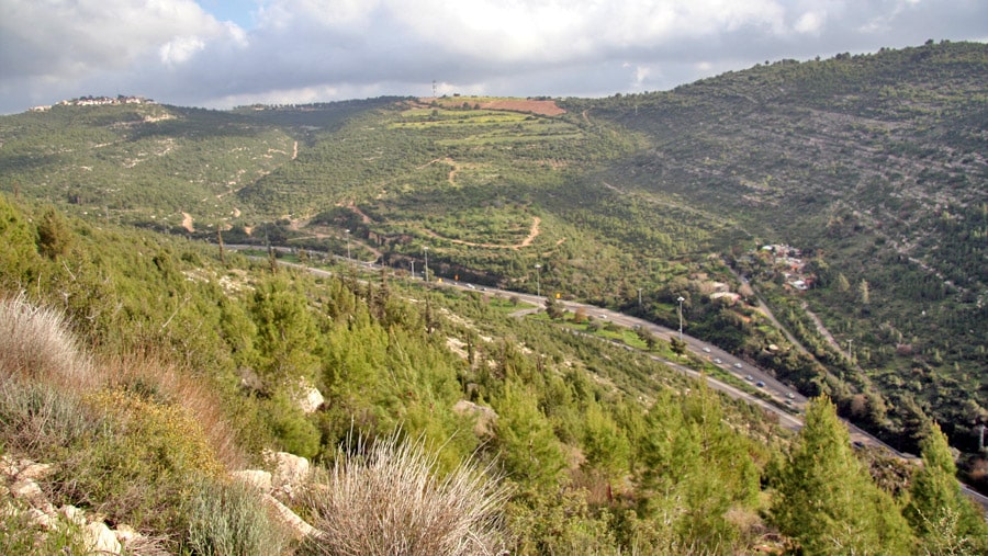
In order to reach Ha-Masrek Reserve and Post 16 Site, we will drive down Hwy 1 towards Shoresh and Beit Meir. As you can see, we are in the connecting point between the Shephelah (Judean Foothills) and the Mountains of Jerusalem, that are above us. The road we are driving on passes on the bottom of the ravine, in a topographically inferior area relative to the ridges around it, so that anyone sitting on the ridge controls the road as well without being physically present on it.
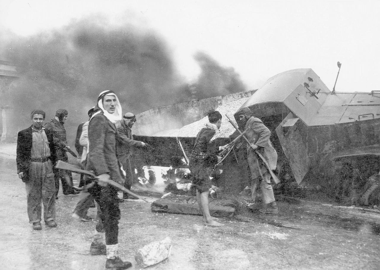
Indeed, according to the testimonials of the convoy drivers, who risked their lives in attempts to maintain the flow of food and supplies to Jerusalem, the main weak point was Sha’ar HaGai, as told by Yona Golani, a truck driver on the convoys to Jerusalem:
“The main difficulty began at Sha’ar HaGai, with the climb up the mountain, with the road winding between forested mountains, which served as excellent observation and hiding places for the gangs. They poured down concentrated fire upon the overloaded trucks, crawling slowly up the mountain.”
Some of the convoys managed to make it to Jerusalem and provide it with the oxygen it needed. The price was high. The attacked convoys were often looted, and the equipment wasn’t merely lost but rather strengthened the Arab enemy. March of 1948 was a particularly grim month for the convoys, which sustained heavy losses, prompting Ben-Gurion to decide on a change in approach. No more heavy convoys crawling up inferior ground, but rather seizing the road to Jerusalem, and controlling the ridges that control the road.

“Operation Nachshon” was conducted as part of the effort to break through to Jerusalem. Although the operation was successful, the Arabs returned afterwards and seized control of the road. An additional operation, “Harel”, was stopped midway due to the need to divert forces to another theater, and the road to Jerusalem was blocked yet again. The next operation that was launched was Operation “Maccabi”, which we will speak of at the first stopping point.
Start of the Route: Operation Maccabi Launches
We turn from Hwy 1 to Road 3955 towards Beit Meir. A little before the entrance to Ha-Masrek Reserve, we will see the sign for “Burma Road”, and we will leave the road to a dirt parking lot on the right side of the road.
A trail (going downhill) comes out of the parking lot, which we will walk on. The trail splits after a few minutes. The left trail (marked red) goes to the Mahal Memorial (which may also be reached on the trail we will use). We will continue right and follow the green marking (and at times, the blue-white-orange marking of the Israel National Trail as well, which overlaps the green trail here). We are headed to Post 16 Site, yet along the way we can also enjoy the Mediterranean grove that surrounds us, and in the months of March and April we will see spectacular blossoming. After a few minutes of moderate walking, the trail turns left (westward). Near the turn, there is a large tree under which we can stop briefly for refreshments. From there the trail continues slightly uphill towards Post 16 Site. In order to understand what Post 16 Site is, we must first understand what “Operation Maccabi” was.

Operation Maccabi, which began on May 8, 1948, lasted 10 days. The operation was named for Maccabi Mutzery-Mani, who had fallen several weeks before on the road to Jerusalem. The goal of the operation was to seize permanent control of the ridges on both sides of the road to Jerusalem, thus allowing a smooth flow of convoys to besieged Jerusalem. In order to seize key points that control Sha’ar HaGai, the Palmach forces not only had to seize the area, but also remain there and repel counterattacks. To that end, the “posts” were built.
A “post” was a defensive array comprised of several positions, similar to an “outpost”. The posts were given names according to an ascending number, beginning in Post 1 on the northern spur (the Posts Spur) up to the southern spur, we are on and on which we shall visit the Post 16 Site.

Post 16 Site: A Microcosmos of the War Over the Road to Jerusalem
With the launch of Operation Maccabi, a company under the command of Uri Ben Ari managed to seize, without a battle, the hill on which Post 16 is located. This takeover was supposed to be a springboard to the continue the capturing of the ridgeline, with an emphasis upon the enemy village of Bayt Mahsir, located at the edge of the ridge (currently, the location of the moshav of Beit Meir). Due to the lack of heavy weaponry (the Davidka Mortar had not arrived in the field), and the desire to not reveal the goals of the operation in order to prevent the arrival of reinforcements, the force received the order to withdraw from the hill.
On the following day, another attempt was made to capture the location, but this time the force encountered resistance by Arabs, who understood what was going on and the military value of the location, and the Palmach force retreated. The following day another attack was carried out, reinforced with weapons and soldiers, and Post 16 was retaken. The Arabs, who understood the importance of the location and its excellent control over the road both to Jerusalem and Bayt Mahsir, quickly organized a fierce counteroffensive, which the force managed to repel while sustaining losses. After repelling this attack, both the nearby Post 17 and Bayt Mahsir were captured, the latter being found abandoned.
Currently, there is a memorial at Post 16, comprised of several pieces, which commemorates the Palmach fighters who fell in the campaign for Jerusalem. A short walking distance from the Post, we can carefully approach the edge of the cliff and get one perspective of Hwy 1 below us, that tells the entire tale, or in the words of the writer Amos Ayalon: “it was clear above all else that the campaign for Jerusalem would not be won in the Old City… rather on that narrow strip of asphalt connecting Jerusalem with Tel Aviv”.
The narrow and winding strip of asphalt below us is exposed in all its strategic vulnerability from the height of Post 16, illustrating the power of the Arab fighters’ vantage point, who sat on the ridge and controlled the road to Jerusalem with gunfire. Don’t let the site of the broad highway fool you. In 1948 it was a road with only one, narrow and winding lane in either direction, with dense vegetation surrounding it on both sides. It is appropriate to recall the words of Benny Marshak, the Culture Officer for the Harel Brigade (“the politruk”): “In all of military history, no other military unit was established for whom the width of its front wasn’t even the width of a road, and it was this width that determine the fate of the country”.

There is no more perfect place to listen to Chaim Guri’s song “Bab al-Wad” (who paradoxically did not fight here at all but rather in the Negev Front).
Heroes of 1948-5708: Not Just the Fighters at the Front
From the observatory, we can return to the path towards Post 16 Site and from there to the vehicle, in the same way we came in. Alternatively, we can continue towards Army 21 Site going downhill. This post is closer to Sha’ar HaGai and is therefore lower. This post was captured on the second night of Operation Maccabi. Operation Maccabi also did not resolve the supply problem to Jerusalem, but we will speak about that on another tour.
On the way back to the vehicle, we can connect with the generation of 1948, a generation in which truck drivers in various convoys stood at the forefront of the fighting, exposed in the cabins, with the fighters dug in in the posts protecting the critical road to Jerusalem with their bodies.
In the vehicle, we may hear the song “Ya Mishlati”, and also connect with the Palmach way of life and the fighters who held the posts, called in the song “my home without walls”.
